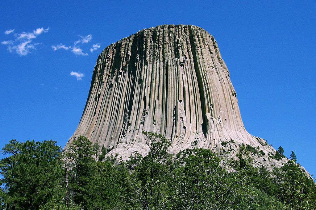
Devil’s Tower
To look at it, a scarp seems like the edge of the world – and, in a manner of speaking, it is. The term “scarp” technically refers to the wall of bare rock that makes up the cliff-face of an area of land that stands much higher than the land that surrounds it. For an extreme example, think of the Devil’s Tower in Wyoming. Quebec City’s Cap Diamant – those gorgeous sheer cliffs just in front of the Château Frontenac dividing the upper section of the town from the Saint Lawrence lowlands below – is a more typical example.
The uplifted area of land sitting above a scarp is known as an escarpment, although the two terms tend to be used interchangeably, except perhaps by geologists. A good way to describe an escarpment is basically as an area of the earth where the elevation changes suddenly. Escarpments are often found along the ocean shore, such as the Devil’s Slide area of California’s Highway One.
Escarpments are also found on dry land. Inland escarpments, where the ground is separated into two level land surfaces divided by a sheer cliff wall, may be formed by erosion, the action of rivers or streams, via seismic activity, or a combination of these forces. And – which makes it interesting for us – many of the world’s wine regions are built around escarpments.
Escarpments created by erosion are generally composed of different types of rock or rocks from different geologic eras. Erosion creates the two levels of land as one of the types of rock erodes much faster than the other. One well-known example of an escarpment formed by erosion is the Niagara Escarpment.
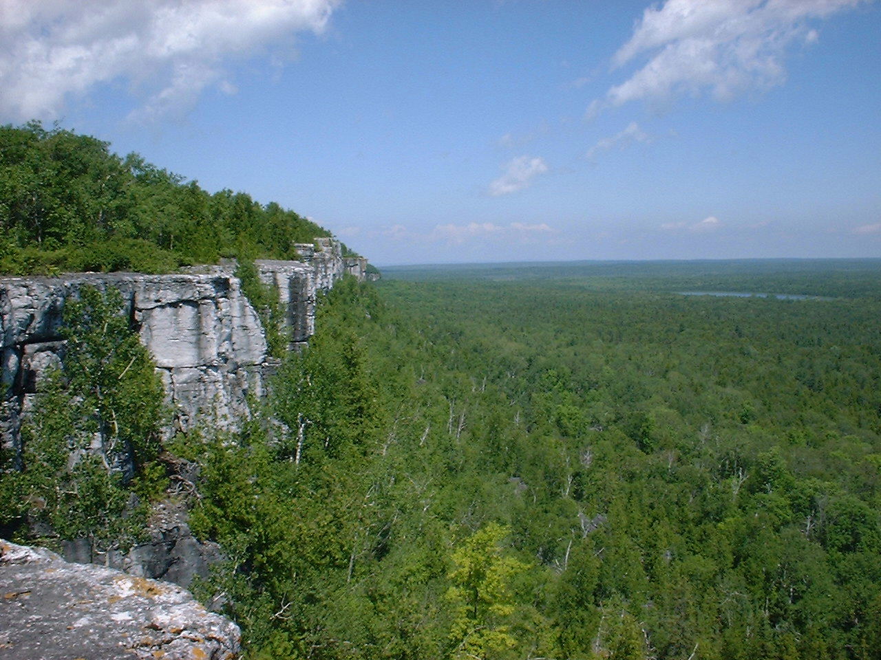
The Niagara Escarpment
The capstone of the Niagara Escarpment is a type of limestone (dolomite rock, or dolostone), while the underlying rock is a more easily erodible shale. The Niagara escarpment is famous for the Niagara Falls, which is the part of the escarpment where the Niagara River plunges over the side. We wine lovers also appreciate the region as the home of the Niagara Escarpment AVA – located along the edge of the ridge, and home to 17 wineries.
Escarpments formed by seismic action are created when a fault displaces the ground surface so that one side is higher than the other. Examples include Africa’s Great Rift Valley and Australia’s Darling Scarp. The Darling Scarp cuts through the wine-growing regions of Western Australia and forms a distinct dividing line between the Perth Hills region, which sits atop the escarpment, and the Swan District, which resides below. The difference in climate between the two next-door neighbor regions due to the resulting change in elevation is striking. The Swan District, resting on the plains below, has a warm-to-hot Mediterranean climate. The Perth Hills, perched above, is characterized by cooler nights, lower temperatures overall, and a harvest that typically begins 10 days to 2 weeks later than its warmer neighbor.
Other escarpments can be found along ancient river valleys, where a river, over the centuries, carved the landscape into a terrace. The Huangarua Scarp, found in New Zealand’s Martinborough wine region, is one example. The Huangarua Scarp is home to several wineries, including Craggy Range and the appropriately named Escarpment Vineyard. The highest uprise of the Huangarua Scarp, at about 150 feet higher than the surrounding area, is believed to have been formed over 250,000 years ago.

“Caprock Escarpment Garza County Texas 2010” by Leaflet – via Wikimedia Commons
The Caprock Escarpment, found in west Texas and eastern New Mexico, was formed via a combination of erosion and water. The top layer of the area is composed of caliche, a type of calcium carbonate that resists erosion. The erosion of the softer underlying stone was aided over the millennium by the action of rivers and streams. The Caprock Escarpment is an abrupt, 200-mile long ridge that divides the high plains area known as the Llano Estacado from the surrounding rolling terrain of the Great Plains below. In some places, the Caprock Escarpment rises more than 1,000 feet above the surrounding plains. The Texas High Plains AVA, covering almost 8 million acres of land, sits atop this huge plateau. The outline of the AVA follows the contour of the ridge at an elevation of 2,800 feet, and extends north and west. At its highest point, the elevation of the Texas High Plains AVA reaches 4,100 feet. The AVA currently has about 4,000 acres of vines and is home to over 75 mostly family-owned vineyards and at least 8 wineries.
Burgundy’s Côte d’Or, Sancerre in the Loire Valley, and Australia’s Murray Darling region are a few of the many other wine regions affected by scarps and escarpments.
For more information please contact Jane Nickles, our Director of Education and Certification at: jnickles@societyofwineeducators.org