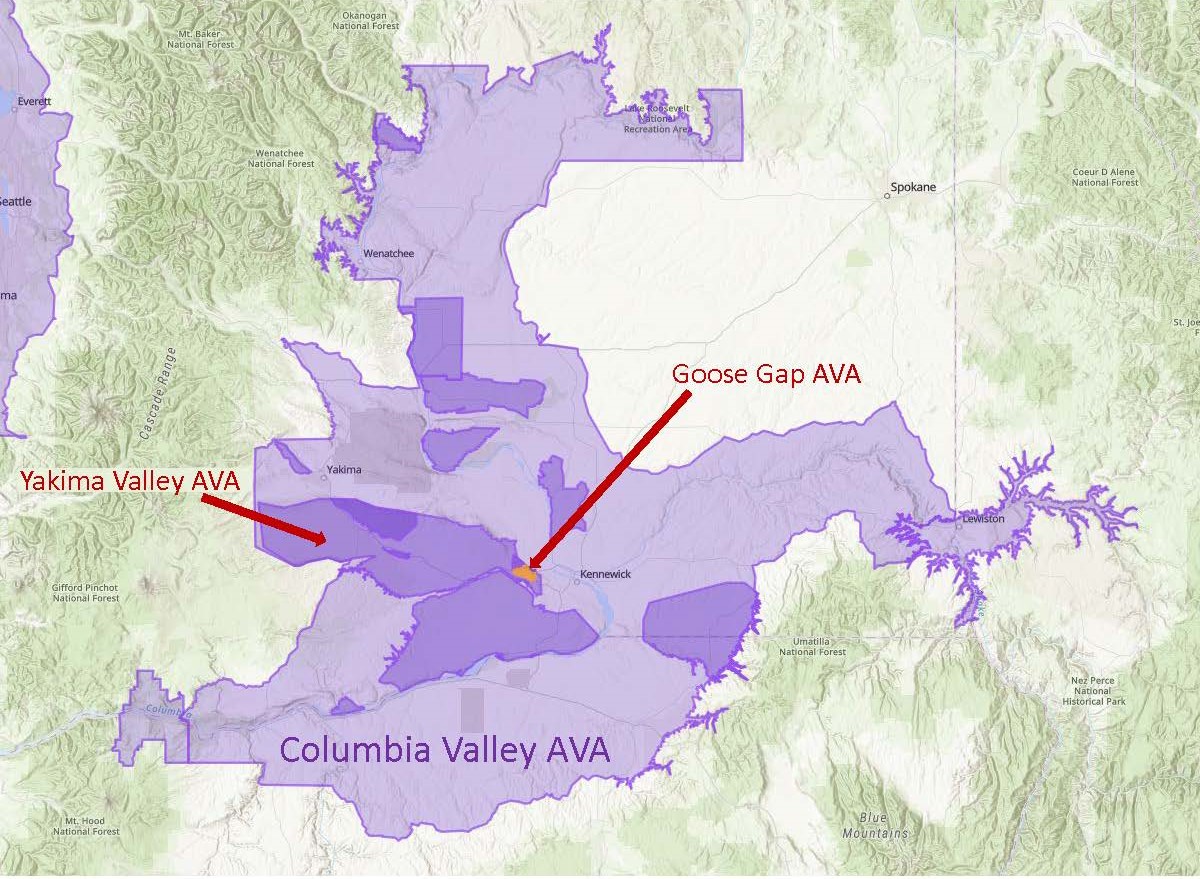
Map via the TTB AVA Explorer
On July 1, 2021, the TTB (Alcohol and Tobacco Tax and Trade Bureau) of the United States announced a newly-approved American Viticultural Area (AVA) for Washington State: Goose Gap AVA. When this new AVA comes into force—on August 2, 2021—the total number of AVAs in the United States will be 256; of these, 19 will be located in Washington State.
Goose Gap is the third new AVA to be approved in Washington State this year; two others—The Burn of Columbia Valley and White Bluffs—were announced just last month (June 17, 2021).
The Goose Gap AVA—a sub-region of both the Yakima Valley AVA and the larger Columbia Valley AVA—is located in Washington State’s Benton County. The triangle-shaped area is tucked between (and to the south of) the Red Mountain AVA and the tiny Candy Mountain AVA.
According to the petition—submitted by Alan Busacca, PhD, on behalf of the Goose Gap Winegrowers Association—the distinguishing features of the Goose Gap AVA include its topography and soils, as discussed below:
Topography: The Goose Gap AVA surrounds (and is mainly to the north of) a basalt ridge known as Goose Hill (sometimes referred to as Goose Mountain). The topography of the area is such that most of the south- and southwest-facing slopes in the area are too steep for successful viticulture; therefore, many of the new AVA’s vineyards are planted on north- and northeast-facing slopes. As a result, the vines in the Goose Gap AVA receive less solar radiation than those planted on the south- and southwest-facing slopes of the nearby appellations, leading to longer growing periods and later harvest dates for the vines of the Goose Gap.
The elevation within the Goose Gap AVA ranges from 577 feet (176 m) above sea level (at the southern boundary) to 1,339 feet (408 m) atop of Goose Hill.
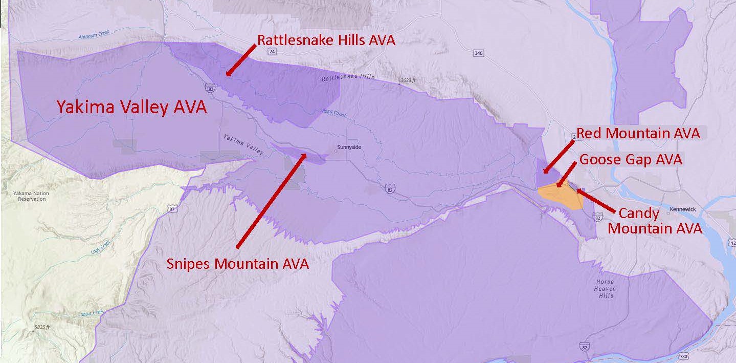
Map via the TTB AVA Explorer
Soils: Many of the soils in the area—covering about 65% of the appellation—consist of wind-blown loess over layered silt and fine-textured sand. In many spots, this topsoil extends for six feet with no hardpan or other root impediments. Other areas of the appellation are also covered by loess, but with varying depths of loess as well as vary amounts of fractured basalt and flood sediment atop the underlying basalt bedrock. The soils of the Goose Gap AVA contain a higher overall percentage of loess, silt, and sand than the soils of the surrounding areas.
The area within the Goose Gap AVA covers a total of 8,129 acres; of these, 1,800 acres (728 ha) are planted to vines. The region is currently home to two commercial vineyards—including the 1,700-acre (688 ha) Goose Ridge Estate Vineyard—and one bonded winery (Goose Ridge Winery). Commercial vineyards specializing in Cabernet Sauvignon and Merlot have been planted in the area since 1998. Other forms of agriculture—including apple orchards, cherry orchards, alfalfa fields, and sheep grazing are traditional to the area.
About that name: The new AVA is located along the migratory path of several flocks of wild geese. The local use of the term “Goose Gap” as well as “Goose Hill” can be traced back to the early 1900s. The area bears the tales of many legendary goose hunts from the 1800s; First Peoples are known to have hunted geese in the area as well.
References/for more information:
- Federal Register- Establishment of the Goose Gap AVA
- Petition to Establish the Goose Gap AVA
- Exhibits – Petition to Establish the Goose Gap AVA
- Washington State Wine (washingtonwine.org)
Post authored by Jane A. Nickles…your blog administrator: jnickles@societyofwineeducators.org