Okanagan’s Eleven (six new appellations for British Columbia)

.

.

Big news out of British Columbia! Six new sub-geographical indications (sub-GIs) have recently been approved for the Okanagan Valley GI.

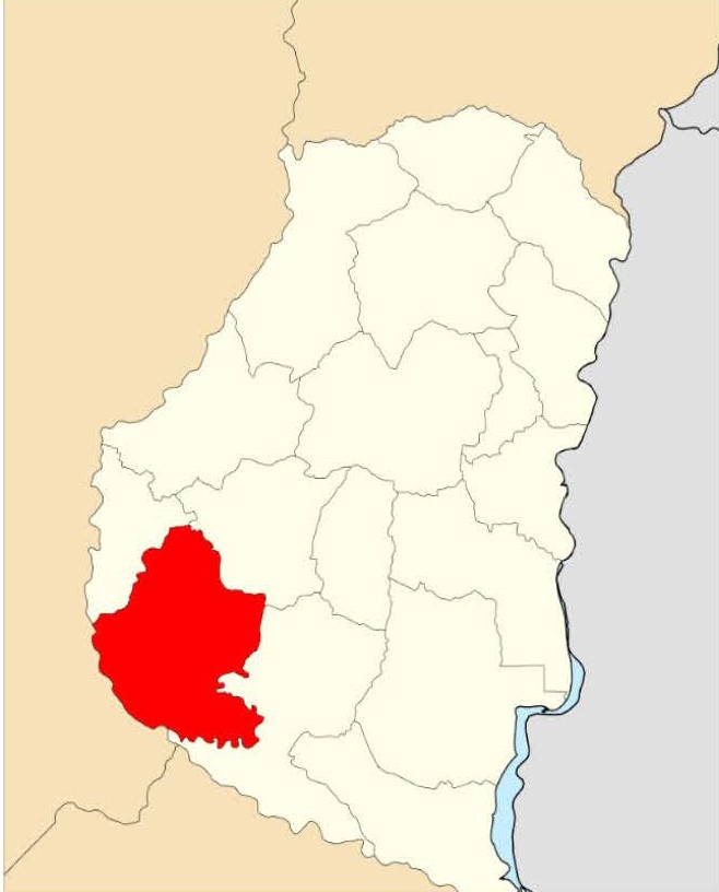
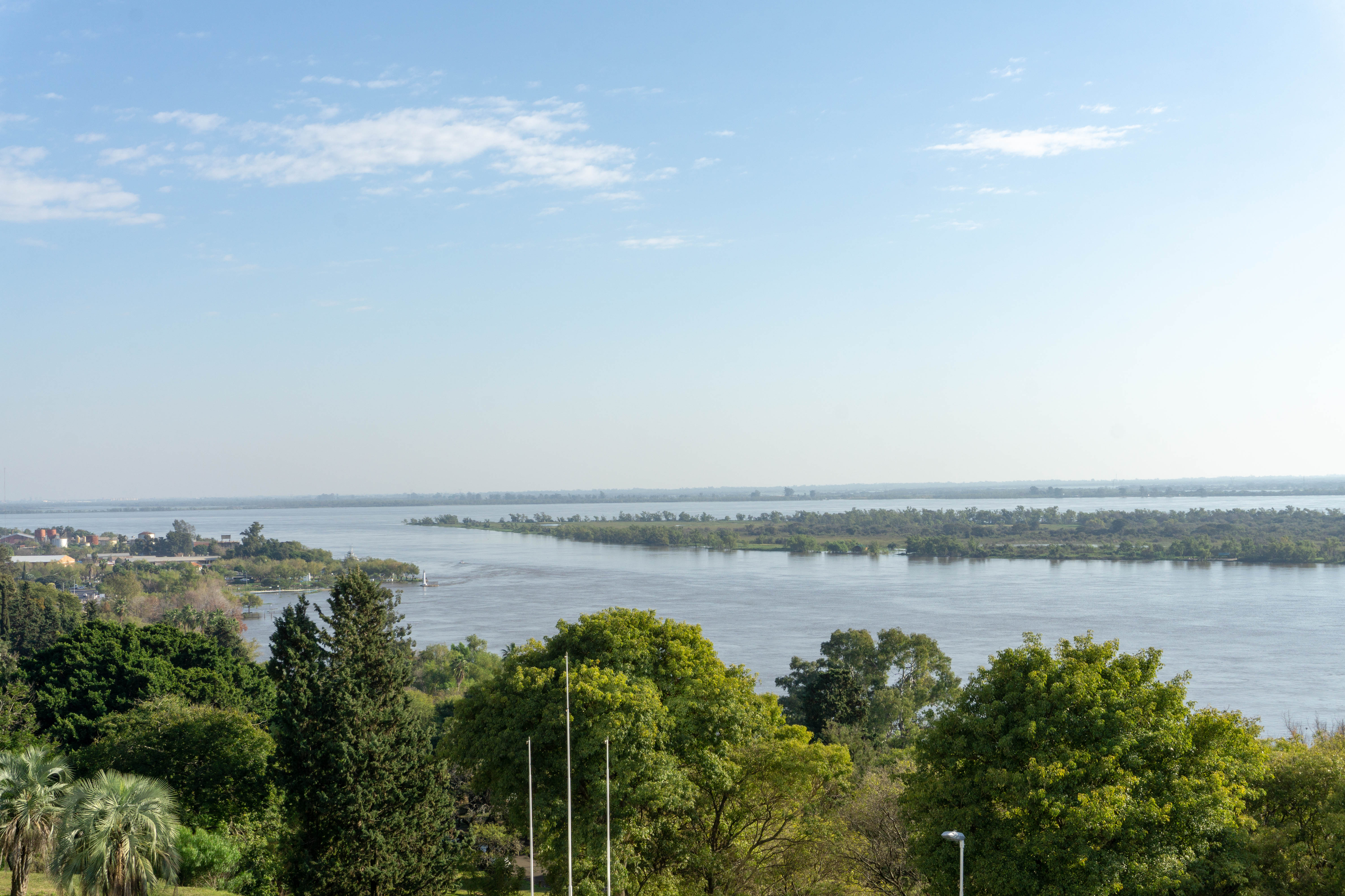
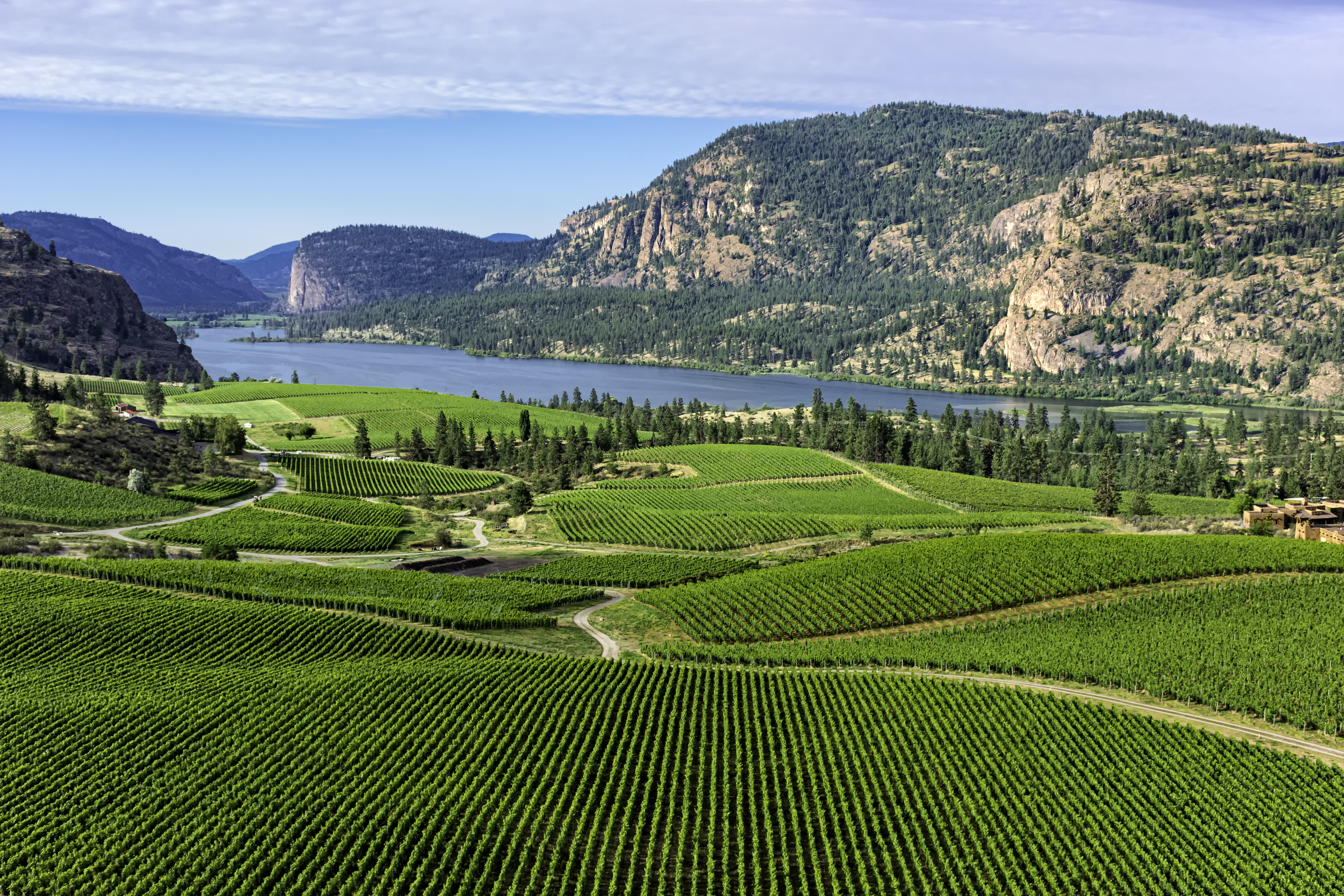
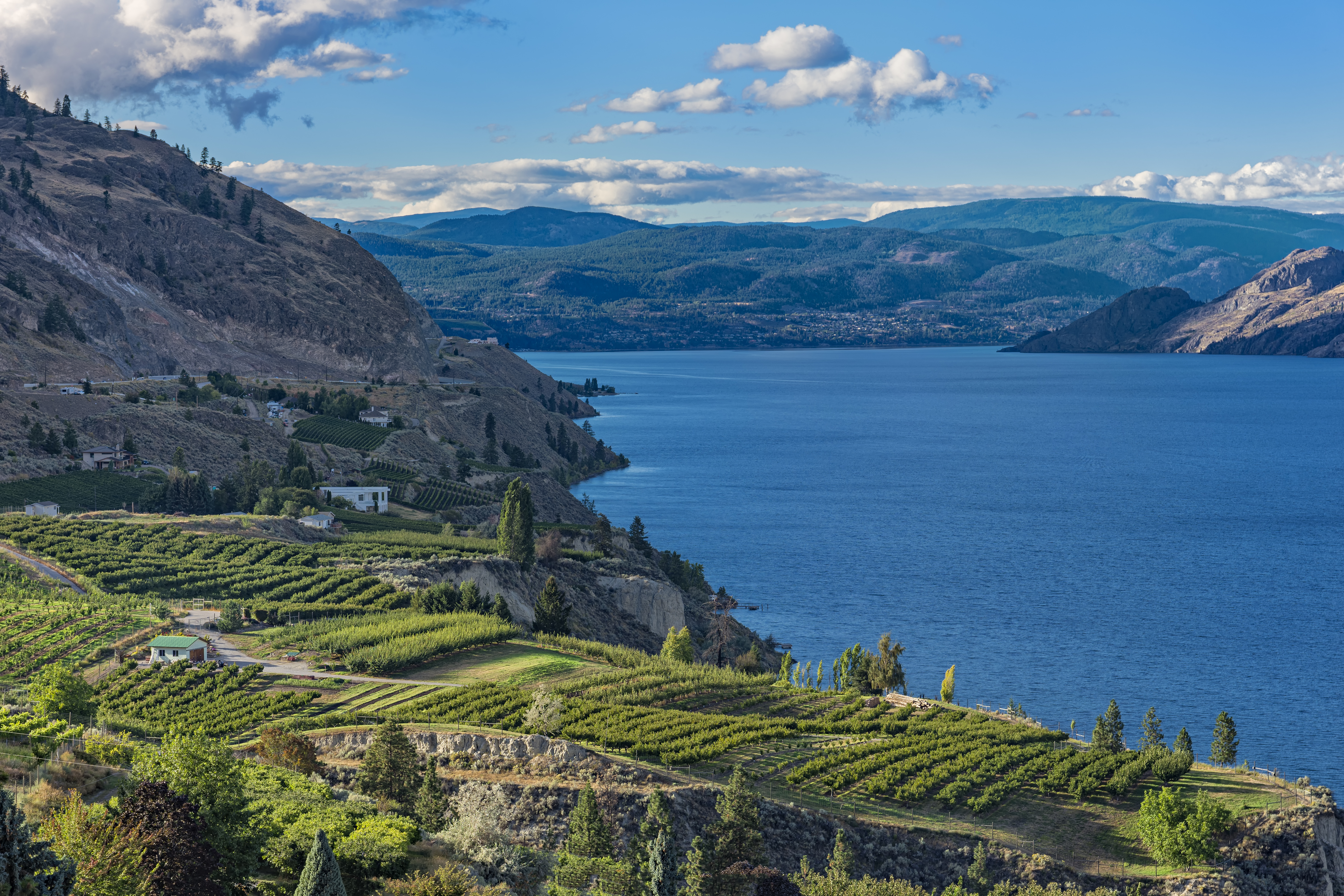
The Okanagan Valley—a long, narrow, and dry valley located inland of the Coast Mountain Range and tucked between the Cascades and the Columbia Mountains—is home to the great majority of British Columbia’s vines. Overall, the valley’s continental climate is somewhat assuaged by the northerly latitude and the presence of Lake Okanagan. However, as evidenced by the recent approval of these new subregions, the large Okanagan Valley is home to several diverse soil types and climate conditions—and supports the production of a wide range of wine types and styles.

The six new sub-appellations are as follows:

East Kelowna Slopes: Covers a series of hillsides overlooking Mission Creek in the central area of the Okanagan Valley. A cool climate area known for premium sparkling wine; the leading grape varieties include Pinot Noir, Riesling, Chardonnay, and Pinot Gris. At this time, about 203 hectares/501 acres are planted to vine. Read the Technical Report for the East Kelowna Slopes Sub-GI here (includes detailed maps of the area).

.

.

Lake Country: Situated near the northern edge of the Okanagan Valley, the Lake Country GI covers the west-facing slopes and benches overlooking a section of the eastern shore of Okanagan Lake. This GI is currently planted to about 100 hectares/247 acres of vines and is known for rich, flavorful Pinot Noir and white varietals. Pinot Noir, Chardonnay, Pinot Gris, Riesling, and Gewurztraminer are the leading varieties. Read the Technical Report for the Lake Country Sub-GI here (includes detailed maps of the area).

South Kelowna Slopes: This small area covers a series of hillsides and slopes on the eastern shore of Okanagan Lake. The region has a unique concentration of mixed glacial sediment (soils). The area currently contains 131 hectares/324 acres of commercial vineyards; leading grape varieties include Pinot Noir, Gamay, Chardonnay, Riesling, Pinot Gris, and Gewurztraminer. Read the Technical Report for the South Kelowna Slopes Sub-GI here (includes detailed maps of the area).

Summerland Bench: This appellation covers the foothills and terraces located to the east and south of Giant’s Head Mountain (on the west shores of Okanagan Lake). The area is largely planted to fruit orchards (apples and cherries), with approximately 60 hectares/148 acres of vines. White grapes (primarily Pinot Gris and Gewurztraminer) dominate the plantings; small plots of Pinot Noir, Merlot, and Syrah are found as well. Read the Technical Report for the Summerland Bench Sub-GI here (includes detailed maps of the area).

Map of the Okanagan Valley GI; copyright Wine Growers British Columbia

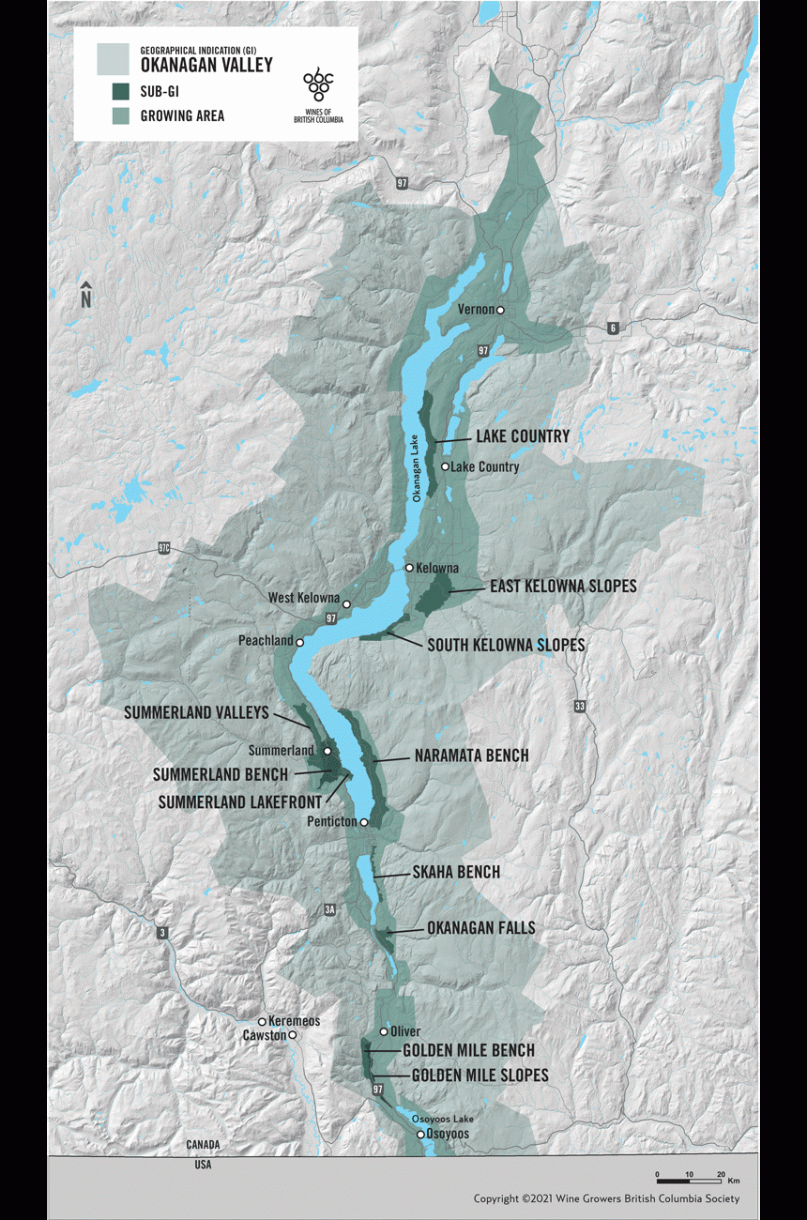
Map of the Okanagan Valley GI; copyright Wine Growers British Columbia (click to enlarge)

Summerland Lakefront: This appellation covers a 12-kilometer (7.5-mile) stretch of land hugging the western shore of Okanagan Lake, near the community of Summerland. The area is largely planted to white grape varieties and currently boasts just over 65 hectares/160 acres of vines. Gewurztraminer and Pinot Gris are the leading varieties; lesser amounts of Pinot Noir and Merlot are grown as well. Read the Technical Report for the Summerland Lakefront Sub-GI here (includes detailed maps of the area).

Summerland Valleys: This appellation contains some of the highest-elevation vineyards in the Okanagan Valley, linking two separate valleys via a stretch of land that runs across Cartwright Mountain. Like the Summerland Bench and Summerland Lakefront GIs, this area is situated around and near the community of Summerland, located on the western shores of Okanagan Lake. There are currently 35 hectares/85 acres of vines planted in the region. Chardonnay is the leading variety. Read the Technical Report for the Summerland Valleys Sub-GI here (includes detailed maps of the area).

Okanagan’s Eleven: These six new sub-appellations join the five already in place—Golden Mile Bench, Golden Mile Slopes, Naramata Bench, Okanagan Falls, and Skaha Bench—for a total of 11.

Okanagan’s Twelve? Hang on to your flashcards…yet another Sub-GI has been proposed. Click here to read the June 2022 Proposal for the Black Sage Bench Sub-GI

References/for more information:  

Post authored by Jane A. Nickles…your blog administrator: jnickles@societyofwineeducators.org


Welcome to the World, Upper Lake Valley AVA!

Map via the TTB AVA Explorer

Map via the TTB AVA Explorer

On June 3 (2022) the TTB (Alcohol and Tobacco Tax and Trade Bureau) of the United States announced the approval of the Upper Lake Valley American Viticultural Area (AVA). The Upper Lake Valley AVA represents the 8th AVA located in Lake County, California.

The newly minted AVA—situated on the north shore of Clear Lake—covers a total of 17, 360 acres and is located entirely within the existing Clear Lake AVA. However, the area of the previously existing Clear Lake AVA was extended (along the northwest corner) in order to accommodate the new appellation within its boundaries.

  • According to the original petition—written by Terry Dereniuk and originally submitted in 2018 on behalf of the Growers of Upper Lake County—the distinguishing features of the Upper Lake Valley AVA include its hydrogeology, soils, and climate, as described below.
    • Hydrogeology: The area of the Upper Lake Valley AVA covers a series of valleys running north-northwesterly from the shores of Clear Lake. These valleys (and the surrounding hillsides) sit at elevations of 1,330 feet to 1,480 feet above sea level; vineyards are currently planted along the valley floors and up into the hillsides—as high as 1,450 feet asl. The area—a transitional region between the Mendocino National Forest and the Clear Lake Basin—has a uniquely high water table (the boundary between the surface and the area where groundwater saturates the soil). This allows for a high degree of dry farming.
    • Soils: The area contains a wide range of soil types, and varies decidedly between the deep, level soils of the valley floors; the thin, well-drained soils on the hillsides; and the marshy areas closest to the lake. Much of the bedrock is composed of shale and sandstone; topsoils include combinations of silt, gravel, clay, and loam.
    • Climate:  The climate of the Upper Lake Valley AVA is slightly cooler than the surrounding areas. The median growing degree days (GDD) in the new AVA ranges from a low of 2,809 to a high of 3,343; in other areas of the Clear Lake AVA, the median high climbs as high as 3,811. The Upper Lake Valley AVA is thus classified as heat summation Region III—Region I is the coolest and Region V is the warmest—according to the often-cited Winkler Scale.
Map via the TTB AVA Explorer

Map via the TTB AVA Explorer

At this time, there are sixteen commercial vineyards, just over 300 acres planted to vine, and one winery located withing the Upper Lake Valley AVA. While a range of grapes—including Cabernet Sauvignon and Zinfandel—are grown in the area, Sauvignon Blanc is the leading variety.

Note: June 3 was a busy day for the TTB, which saw the approval of four new AVAs, including Upper Lake Valley. The other three include Rocky Reach (WA), Paulsell Valley (CA), and Mount Pisgah-Polk County (OR). When all four of these AVAs are brought into force—on July 5, 2022—the total number of AVAs in the United States will be 266; of these, 146 will be in California.

Welcome to the world, Upper Lake Valley AVA!

References/for more information:

Post authored by Jane A. Nickles…your blog administrator: jnickles@societyofwineeducators.org

California Earns another: the Paulsell Valley AVA!

Map via the TTB AVA Explorer

Map via the TTB AVA Explorer

On June 3 (2022) the TTB (Alcohol and Tobacco Tax and Trade Bureau) of the United States announced the approval of the Paulsell Valley American Viticultural Area (AVA), located in Stanislaus County, California.

The new AVA is located in the San Joaquin Valley (Central Valley), somewhat between the town of Knights Ferry and the Modesto Reservoir. The Paulsell Valley AVA is situated to the west of the Sierra Foothills AVA and to the south of the Lodi AVA; it does not, however, overlap with any previously established viticultural area. The name Paulsell refers to a nearby unincorporated community—sometimes known as Old Paulsell Town—and the valley that runs through it, carved by Dry Creek

  • According to the original petition—originally submitted in 2018 by Patrick L. Shabram on behalf of the grape growers in the area—the distinguishing features of the Paulsell Valley AVA include its topography, soils, and climate, as described below.
    • Topography: The landscape within the new AVA consists mainly of rolling hills interspersed with water-carved channels and steep, isolated hills known as intermounds. This type of landscape is known as mound-intermound relief and is unique to the area (as compared with the surrounding landscape). Elevations in the Paulsell AVA range from 140 to 612 feet asl. The numerous slopes allow for excellent drainage, while the isolated patches of higher elevation (located towards the top of the intermounds) allow for long hours of sun exposure.
    • Soils: The soils of the Paulsell Valley AVA consist mainly of volcanic tuff (a sedimentary soil created via the compaction of volcanic ash and bits of igneous rock) and alluvial deposits. In some spots, the topsoil contains cobbles—small rocks typically defined as being 2.5 to 10 inches in diameter, sometimes referred to as cobblestones—remnants of significant flooding.
    • Climate: The climate of the Paulsell Valley AVA is slightly warmer than the areas that surround it, and slightly drier than the area within the Sierra Foothills AVA. The (average) temperature within the new AVA is well above 4100 growing degrees days (GDD); by any accounts this is a warm, dry, inland area well-suited to the cultivation of hardy red grapes.
Map via the TTB AVA Explorer

Map via the TTB AVA Explorer

The Paulsell Valley AVA—covering a total area of 34,155 acres—contains three commercial vineyards and approximately 826 acres planted to vine (with more planned for the future). The leading grape varieties include Cabernet Sauvignon, Petit Verdot, and Petite Sirah.

Note: June 3 was a busy day for the TTB, which saw the approval of four new AVAs, including Paulsell Valley. The other three include Rocky Reach (WA), Upper Lake Valley (CA), and Mount Pisgah-Polk County (OR). When all four of these AVAs are brought into force—on July 5, 2022—the total number of AVAs in the United States will be 266; of these, 146 will be in California.

Welcome to the world, Paulsell Valley AVA!

References/for more information:

Post authored by Jane A. Nickles…your blog administrator: jnickles@societyofwineeducators.org

Welcome to the world, Mount Pisgah-Polk County AVA!

Map via the TTB AVA Explorer

Map via the TTB AVA Explorer

On June 3 (2022) the TTB (Alcohol and Tobacco Tax and Trade Bureau) of the United States announced the approval of the Mount Pisgah-Polk County American Viticultural Area (AVA), located in Oregon. The newly minted AVA is located entirely within the existing Willamette Valley AVA and represents the 23rd AVA located in Oregon. With the approval of the new AVA, the Willamette Valley AVA now has 11 sub-appellations.

The Mount Pisgah-Polk County AVA covers a total of 5,850 acres surrounding the 835-foot summit of Mount Pisgah, located about 15 miles west of Salem (and just south of the town of Dallas, Oregon).

  • According to the petition to establish the appellation—originally submitted in 2018—the distinguishing features of the Mount Pisgah-Polk County AVA include its topography, climate, and soils, as described below.
    • Topography: The new AVA is located within a chain of small hills in the Willamette Valley area. Elevations range from 260 feet to 835 feet asl (at the peak of Mount Pisgah); the areas surrounding the Mount Pisgah-Polk County AVA are all at lower elevations.
    • Climate: The Mount Pisgah-Polk County AVA is somewhat cooler than the surrounding valley floor. The average annual growing degree days (GDD) for Mount Pisgah total 2,543 GDD; the surrounding areas total 2,661 GDD (in the tow of McMinnville, to the south) and 2,903 GD (in the town of Salem, to the east).
    • Soils: Like much of the surrounding area, the dominant soil of the Mount Pisgah-Polk County AVA is sedimentary in nature (to include sandstone and siltstone). While the remainder of the Willamette Valley AVA has a large percentage of soils derived from the Missoula Floods, in the new AVA only 2.1% of the area is so affected. Rather, due to the higher elevation of the area, the soils of the Mount Pisgah-Polk County AVA contain a high percentage of volcanic rocks that were part of an ancient seabed. These rocks are among the oldest rocks within the Willamette Valley, and the Mount Pisgah area is the only spot in the Willamette Valley that combines sedimentary soils with such ancient parent material.
Map via the TTB AVA Explorer

Map via the TTB AVA Explorer

At the time of the original petition, there were 10 commercial vineyards (planted to a total of 531 acres of vines) and 2 wineries—Amelie Robert Estate and Ilahe Vineyards—located within the area of the Mount Pisgah-Polk Count AVA. Pinot Noir, Pinot Gris, and Chardonnay are the leading grape varieties.

Note: The official name of the new AVA reads as follows: Mount Pisgah, Polk County, Oregon AVA. The name includes the name of the county as there are at least three locations in Oregon named Mount Pisgah. As other states also have areas named Mount Pisgah, the term Oregon is also part of the official name of the AVA.

Welcome to the world, Mount Pisgah-Polk County AVA!

On another note: June 3 was a busy day for the TTB, which saw the approval of four new AVAs, including Mount Pisgah. The other three include Rocky Reach (WA), Upper Lake Valley (CA), and Paulsell Valley (CA). When all four of these AVAs are brought into force—on July 5, 2022—the total number of AVAs in the United States will be 266.

References/for more information:

Post authored by Jane A. Nickles…your blog administrator: jnickles@societyofwineeducators.org

Welcome to the World, Rocky Reach AVA!

Map via the TTB AVA Explorer

Map via the TTB AVA Explorer

On June 3 (2022) the TTB (Alcohol and Tobacco Tax and Trade Bureau) of the United States announced the approval of the Rocky Reach American Viticultural Area (AVA)., located in portions of Chelan and Douglas Counties in Washington State. The newly minted AVA is located entirely within the existing Columbia Valley AVA and represents the 20th AVA located in Washington State.

The Rocky Reach AVA covers a long, narrow strip of land that straddles a portion of the Columbia River. This stretch of the Columbia River consists of a deep canyon between two sets of rolling hills (the foothills of the Cascade Mountains to the west and Badger Mountain to the east). The new AVA is situated between the Lake Chelan AVA (located a few miles to the north) and the Ancient Lakes of Columbia Valley AVA (located a few miles to the southeast).

  • According to the petition to establish the appellation—originally submitted in 2018 by Kevin Pogue PhD, Professor of Geology at Whitman College—the distinguishing features of the Rocky Reach AVA include its topography, soils, and climate, as described below.
    • Topography: The area within the Rocky Reach AVA consists of a deep canyon eroded over time by the rapids of the Columbia River. The prime vineyard areas are located along flat-topped terraces that line either side of the river.
    • Soils: Loess (windblown sand and silt) is the leading soil type of the Rocky Reach AVA and other parts of the Columbia Valley. However, unlike the surrounding areas, the soils in the Rocky Reach AVA are topped with gravel and cobblestones. The bedrock of the region is also unique—in the Rocky Reach and Lake Chelan AVAs, the bedrock is silica-rich sedimentary rock. This type of bedrock soil is unique, as most of the surrounding vineyard areas are composed of basalt bedrock.
    • Climate: The deep canyon of the Rocky Reach AVA sits at an elevation that is considerably lower than the surrounding areas. As such, the area within the AVA is significantly warmer, resulting in a longer growing season than the surrounding areas.
Map via the TTB AVA Explorer

Map via the TTB AVA Explorer

At the time of the proposal, there were 7 commercial vineyards within the area defined by the Rocky Reach AVA with a total of 117 acres planted to vine. Cabernet Sauvignon is the leading grape variety.

The name Rocky Reach has been applied to this section of the Columbia River since the 1800s. In those days, steamboat captains used the term to describe the 8-mile-an-hour rapids that formed certain times of the year. Successful navigation of the rocky reach required staying within the deepest channel of the river to avoid the rocks just beneath the surface of the water.

Note: June 3 was a busy day for the TTB, which saw the approval of four new AVAs, including Rocky Reach. The other three include Upper Lake Valley (Lake County, CA), Mount Pisgah (Polk Country, OR), and Paulsell Valley (Stanislaus County, CA).  When all four of these AVAs are brought into force—on July 5, 2022—the total number of AVAs in the United States will be 266.

Welcome to the world, Rocky Reach AVA!

References/for more information:

Post authored by Jane A. Nickles…your blog administrator: jnickles@societyofwineeducators.org

Welcome to the World, Vino de Pago Abadía Retuerta!

Photo via: www.abadia-retuerta.com

Photo via: www.abadia-retuerta.com

On May 31 (2022) the Official Journal of the European Union announced the approval of a new PDO wine region for Spain: Vino de Pago Abadía Retuerta.

The newly approved appellation is located in the municipality of Sardón de Duero (Valladolid), in the autonomous community of Castilla y León. Sardón de Duero is situated just to the west of the Ribera del Duero DO. This section of the Duero River has long been considered to be an ideal area for vineyards as part of the informally recognized Milla de Oro (Golden Mile) of wine estates in the area.

The Abadía Retuerta estate is built on the site of the Abbey of Santa María de Retuerta— founded in 1146 by Sancho Ansúrez near the banks of the Duero River. Some parts of the original structure still stand and are considered to be among the most important works of Romanesque architecture in the area.

The Abadía Retuerta estate currently includes a winery, hotel, the Santuario Wellness Spa, and several restaurants. In addition to Vino de Pago Abadía Retuerta, the estate produces a range of varietal and blended wines under the Vino la Tierra de Castilla y León appellation as well as food products such as pine nuts and honey.

The Vino de Pago Abadía Retuerta is approved for dry red wines (monovarietal or blends) produced from Petit Verdot, Tempranillo, Cabernet Sauvignon, Cabernet Franc, Garnacha Tinta, Malbec, Merlot, Graciano, Syrah, and/or Pinot Noir. All red wines must be matured in oak barrels for at least six months. Dry white wines—monovarietal or blends—may be made with Albillo Mayor, Godello, Verdejo, Riesling, Sauvignon Blanc, and/or Gewürztraminer.

P.S. On this same day (May 31, 2022), the EU also announced the approval of the Vino de Pago Bolandin, located in Navarra. You can read more about the Vino de Pago Bolandin here. With the approval of these two new appellations, there are currently 24 vino de pago appellations in Spain (per the EU).

Welcome to the World, Vino de Pago Abadía Retuerta!

References/for more information:

Post authored by Jane A. Nickles…your blog administrator: jnickles@societyofwineeducators.org

Welcome to the World, Vino de Pago Bolandin!

Photo via: pagodecirsus.com

Photo via: pagodecirsus.com

On May 31 (2022) the Official Journal of the European Union announced the approval of a new PDO wine region for Spain: Vino de Pago Bolandin.

The newly approved appellation is located in the autonomous community of Navarra, within the municipality of Ablitas. The area is very close to the southern edge of Navarra, to the east of La Rioja and close to the border shared with Aragon. This places it within the Ribera Baja sub-region of the Navarra DO. 

The 130-hecatare/320-acre Bolandin Vineyard is part of Bodega Pago de Cirsus, which operates a winery, restaurant, and hotel on the estate. Bodega Pago de Cirsus produces a wide range of products, to include (in addition to Vino de Pago Bolandin) olive oil, white truffle oil, and table wines bottled under the DO Navarra.

The climate of the estate—which sits between the Ebro River and the Moncayo Mountains at an average elevation of 395 meters/1,295 feet above sea level—may be described as “extreme continental,” meaning it tends to experience very cold winters and hot, dry summers. The estate benefits from the Cierzo—a strong dry wind that flows to the northwest from the Ebro River Valley—as well as a series of nearby reservoirs that provide water for irrigation as needed.

The Vino de Pago Bolandin appellation is approved for dry red wines and dry white wines; the main grape varieties include Cabernet Sauvignon, Merlot, Syrah, Tempranillo, Chardonnay and Sauvignon Blanc. Sweet white wines—produced using late harvest (sobremadurada) Moscatel Grano Menudo (Muscat Blanc à Petits Grains) grapes and containing a minimum of 45 g/L residual sugar—are also allowed.

Welcome to the world, Vino de Pago Bolandin!

P.S. On this same day (May 31, 2022), the EU also announced the approval of the Vino de Pago Abadía Retuerta, located in Castilla y León. You can read more about the Vino de Pago Abadía Retuerta here. If we include these two newly-approved appellations, there are currently 24 vino de pago appellations in Spain (per the EU).

References/for more information:

Post authored by Jane A. Nickles…your blog administrator: jnickles@societyofwineeducators.org

Welcome to the World, West Sonoma Coast AVA!

Map via the TTB AVA Explorer

Map via the TTB AVA Explorer

On May 23 (2022) the TTB (Alcohol and Tobacco Tax and Trade Bureau) of the United States announced the approval of the West Sonoma Coast American Viticultural Area (AVA). The newly minted AVA is located entirely within the existing Sonoma Coast AVA and is a sub-appellation of the larger North Coast AVA. The West Sonoma Coast AVA—which encompasses the existing Fort Ross-Seaview AVA—represents the 19th AVA located in Sonoma County.

The West Sonoma Coast AVA hugs the coastline of Sonoma County and exhibits an overall cool, maritime climate often described as cool enough to be marginal. The AVA currently contains more than fifty commercial vineyards (totaling just over 1,000 acres) planted within five to seven miles of the Pacific Ocean. The leading grape varieties include Pinot Noir, Chardonnay, and Syrah.

According to the original petition to establish the AVA—originally submitted to the TTB in December of 2018 by Patrick L. Shabram on behalf of the members of the association of West Sonoma Coast Vintners—the distinguishing features of the West Sonoma Coast AVA include its topography, geology, and climate, as described below.

.

.

Topography: The West Sonoma Coast AVA is rugged territory, much of it defined by the steep mountains and ridgelines of the California Coast Range. The mountains in this area—often referred to as the Sonoma Coast Highlands—can reach as high as 1,000 feet/31 meters asl. Many of the vineyards are planted on the hillsides and mountain slopes, which are typically in excess of 5 degrees.

Geology: Much of the area within the West Sonoma Coast AVA consists of sedimentary bedrock and soils of the Franciscan Complex (which includes greywacke, shale, and sedimentary conglomerates). Rocks of the Franciscan Complex are not easily eroded, which contributes to the rugged ridgelines and steep slopes of the region. The soils have a high level of sand content, providing excellent drainage and low fertility.

Climate: As evidenced by its location, the West Sonoma Coast is a maritime climate highly influenced by coastal breezes, fog, and cool temperatures—much more so even than the surrounding areas including the Russian River Valley, Petaluma Gap, and the interior areas of the Sonoma Coast AVA. The West Sonoma Coast AVA is truly positioned to be a leader in cool climate viticulture!

When the West Sonoma Coast AVA comes into force on June 22 (2022), the total number of AVAs in the United States will be 262. Of these, 144 will be in California.

Welcome to the world, West Sonoma Coast AVA!

References/for more information:

 Post authored by Jane A. Nickles…your blog administrator: jnickles@societyofwineeducators.org

A Pinot Noir Pivot in the Alsace Grand Cru

.

.

Big news for lovers of all things Alsace! Two (of the 51) Grand Cru AOCs of Alsace have revised their regulations so that they now allow for the production of Alsace Grand Cru Rouge—made with 100% Pinot Noir!

Before these changes—announced via publication in the Journal Officiel de la République Française on May 13, 2022—wines of the Alsace Grands Crus were exclusively white. In addition—with very few exceptions*—only varietal wines produced from one of the noble grapes of Alsace (Riesling, Pinot Gris, Gewurztraminer, and Muscat) were allowed to be labeled as Alsace Grand Cru AOC wines.

However, things have evolved and now Alsace Grand Cru Hengst and Alsace Grand Cru Kirchberg de Barr are approved for vins blancs et rouges tranquilles (both white and red wines, still/not sparkling). All other Grand Cru AOCs sont réservées aux vins blancs tranquilles (are reserved for still white wines).

.

.

Alsace Grand Cru Hengst covers 53 hectares/131 acres in an area south of the Haut-Rhin commune of Wintzenheim (near Colmar). Vines have been planted here—at altitudes of 260–350 meters/853–1,150 feet asl, along a steep hillside sloping to the southeast—since the 9th century. The soils—consisting of clay and marl flecked with limestone—help to enable the ripening of the Pinot Noir grapes of the region, known to produce wines with silky tannins and lively flavor.

The region’s Pinot Noir vineyards must have a minimum planting density of 5,500 vines per hectare and red wines must have a minimum of 12.5% alcohol by volume. The Alsace Grand Cru Hengst AOC was first approved in 1983 for white wines; red wines will be allowed as of the release of the 2021 vintage.

.

.

Alsace Grand Cru Kirchberg de Barr covers 40 hectares/99 acres located on a steep hill (with an incline of almost 30°) overlooking the Bas-Rhin commune of Barr. The vineyards enjoy an ideal south/southeast aspect and an average elevation of 220–350 meters/722–1,150 feet asl. The soil consists of thick deposits of clay, limestone, and marl interspersed with gravel (that helps to retain warmth). The area has a unique sun capture and a slightly warmer temperature than surrounding areas (as the cold air flows downhill). All of this combines to create an ideal micro-climate for Pinot Noir.

The region’s Pinot Noir vineyards must have a minimum planting density of 5,000 vines per hectare and red wines must have a minimum of 12% alcohol by volume. The Alsace Grand Cru Kirchberg de Barr AOC was first approved in 1983 for white wines; red wines will be allowed as of the release of the 2021 vintage.

All wines produced under the category of Alsace Grand Cru/Rouge must adhere to the following new standards:

  • They must undergo malolactic fermentation (maximum allowed malic acid content is 0.4 grams per liter)
  • They must be dry (maximum allowed level of fermentable sugars is 2 grams per liter)
  • They must be aged until (at least) October 1 of the year following the harvest
  • As is true of all Alsace Grand Cru AOC wines, they must vintage-dated and packaged in the traditional Flûte d’Alsace bottle

Welcome to the world, Alsace Grand Cru Rouge!

As with all such updates, this change will need to wind its way through EU authorization; however, as the government of France has granted their approval, the changes will be in force (as scheduled) with the release of the wines of the 2021 vintage. If the EU fails to approve the amendment, the regulation will be rescinded (although this is quite unlikely to happen).

*Previous exceptions to the “only varietal wines made using the noble varieties” rule include Zotzenberg (approved for the use of Sylvaner) and Kaefferkopf (approved for white blends).

References/for more information:

Post authored by Jane A. Nickles…your blog administrator: jnickles@societyofwineeducators.org

Welcome to the World, Victoria (Entre Ríos) GI!

Map of Argentina with Entre Ríos highlighted, via WikiMedia Commons

Map of Argentina with Entre Ríos highlighted, via WikiMedia Commons

Argentina has added another geographical indication (GI) for quality wine production to its growing list: the Victoria GI. Victoria (also the name of a political region/department) is located in the Argentine province of Entre Ríos.

Entre Ríos—the name translates to between rivers—is located along the eastern border of the large country of Argentina, just to the west (inland of) Uruguay and north of the province of Buenos Aires. As befits the name of the province, the borders of Entre Ríos are defined by several rivers—primarily the Paraná River to the west, and the Uruguay River to the east—both of which eventually end up as part of the area’s famous Río de la Plata estuary.

The western portion of the Entre Ríos region is largely agricultural, and is a significant producer of rice, soybeans, wheat, citrus fruit, and livestock (poultry and cattle). The climate in the southwestern corner of Entre Ríos—where Victoria is located—is humid and temperate with average temperatures of 10 °C/50 °F (winter) to 26 °C/79 °F (in the summer).

Map of Entre Ríos with the Victoria GI highlighted via the República Argentina

Map of Entre Ríos with the Victoria GI highlighted via the República Argentina

The population includes large numbers of immigrants from Italy, Spain, Germany, Switzerland, France, Russia, and Poland. As can be expected, many of these families brought the tradition of viticulture and wine making along with them. The area was at one time home to 5,000 hectares of vineyards and more than 60 wineries, but many of these were neglected following the political upheaval of the 1930s. Many of the region’s remaining vineyards were literally sought out and uprooted after the passing—in 1934—of a National Wine Law (Ley Nacional de Vinos/No. 52.137). This law prohibited wine production in Argentina outside of the designated area of the Cuyo Region (centered around Mendoza) and was intended to encourage settlement in the western areas of the country.

The regional prohibition in Entre Ríos was officially rescinded in 1993 and commercial viticulture has returned to the area. One significant local winery—BordeRío Bodega & Viñedos—prides itself on “revaluing a forgotten wine tradition” and has 18 hectares/45 acres planted to vinifera grapes (in addition to 7,000 olive trees and a state-of-the-art wine production facility). Leading grapes include Malbec, Merlot, Cabernet Franc, Syrah, Chardonnay, and Torrontés.  The winery produces varietal wines (both red and white), blended rosé, and several versions of sparkling wine.

View of the Paraná River

View of the Paraná River

Research into the wine culture of Entre Ríos revealed a significant number of wine bars in addition to the region’s commercial vineyards and wineries—including Finca La Josefina y Vinos Annelise, Finca Los Bayos Chacra de Viñas, and Viñas De Victoria in addition to BordeRío Bodega & Viñedos. It certainly seems to be a re-discovered/up-and-coming wine region of Argentina!

Welcome to the world, Victoria/Entre Ríos GI!

References/for more information:

Post authored by Jane A. Nickles…your blog administrator: jnickles@societyofwineeducators.org