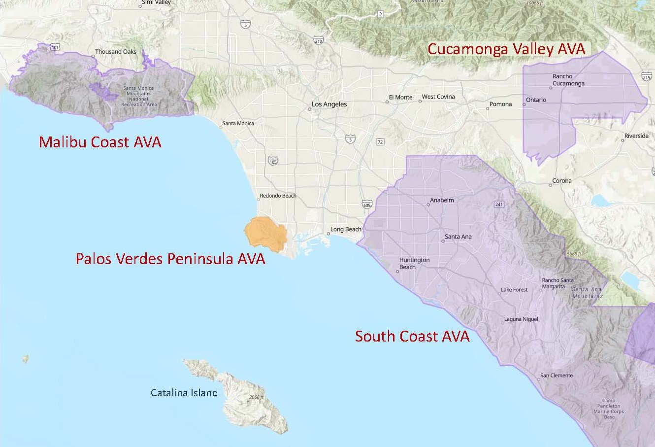
Map via the TTB AVA Explorer Map
On June 17, 2021, the TTB (Alcohol and Tobacco Tax and Trade Bureau) of the United States approved the Palos Verdes Peninsula AVA. When this new AVA comes into force—on July 19, 2021—the total number of AVAs in the United States will be 255, of which 142 will be in California.
The Palos Verdes Peninsula area—located in the southwestern corner of Los Angeles County—hugs the Pacific Ocean coastline about 25 miles west of downtown Los Angeles. The region includes the cities of Palos Verdes Estates, Rolling Hills Estates, Rancho Palos Verdes, and Rolling Hills, California. The area is highly regarded for its sweeping views of the ocean and the Los Angeles city skyline, gated communities, and high-dollar homes. However, the area has a long history of agriculture—including some viticulture—and wine continues to be produced in the area.
According to the original petition—spearheaded by James York of Catalina View Wines and submitted on behalf of a group of Palos Verdes Peninsula winegrowers—the area’s distinguishing characteristics include its topography, soils, and climate. These are discussed below:
Topography: The area within the Palos Verdes Peninsula AVA consists of low rolling hills (technically part of the Coast Range) situated between the Los Angeles Basin and the Pacific Ocean. Elevations range from sea level (on the region’s western and southern edges) to 1,460 feet/445 m above sea level at San Pedro Hill. Many of the region’s vineyards are planted on moderate south- or southeast-facing slopes.
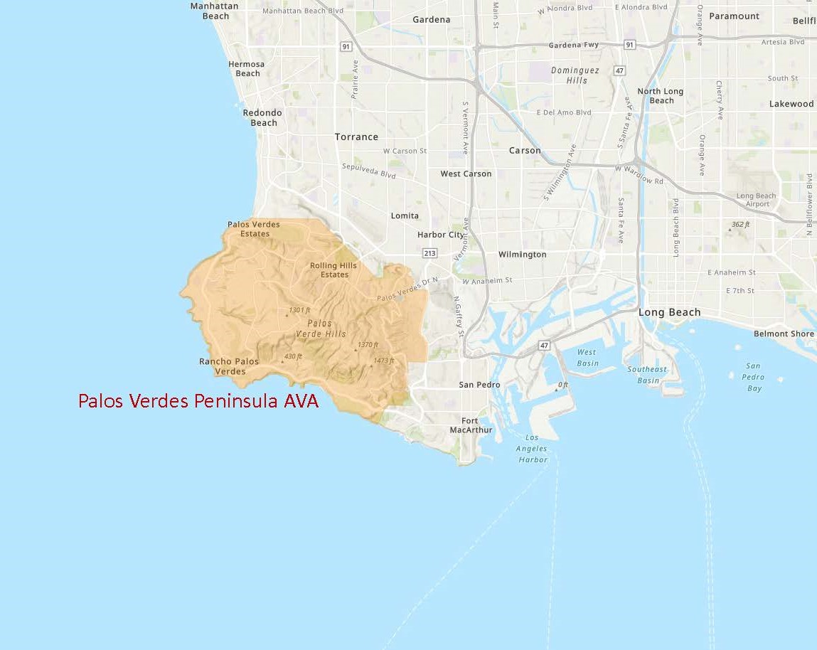
Map via the TTB AVA Explorer Map
Soils: The soils of the region include Altamont Clay Adobe, Altamont Clay Loam, and Diablo Clay Adobe. These soils are composed primarily of fine-grained sandstone, weathered shale, silt, and calcareous clay. These soils retain allow for moisture retention in dry weather while allowing for drainage during rainy times.
Climate: Like many areas of Southern California, the Palos Verdes Peninsula AVA has an overall Mediterranean Climate coupled with the coastal influence of the nearby Pacific Ocean. The area typically experiences warm, dry summers (temperatures rarely exceed 84°F/29°C) and mild winters with limited rainfall.
The Palos Verdes Peninsula AVA includes a total of 15,900 acres; of these, just over 7 acres are currently planted to vines. Two producing wineries—Catalina View Wines and La Caze Family Vineyard—are located within the region. The leading grape varieties include Pinot Noir, Chardonnay, Cabernet Sauvignon, and Merlot
Welcome to the world, Palos Verdes Peninsula AVA!
References/for more information:
- Federal Register – Establishment of the Palos Verdes Peninsula AVA
- Petition to Establish the Palos Verdes Peninsula AVA
- Palos Verdes as wine region? Jim York wants Peninsula-grown grapes in your glass. – Southbay (goldenstate.is)
Post authored by Jane A. Nickles…your blog administrator: jnickles@societyofwineeducators.org