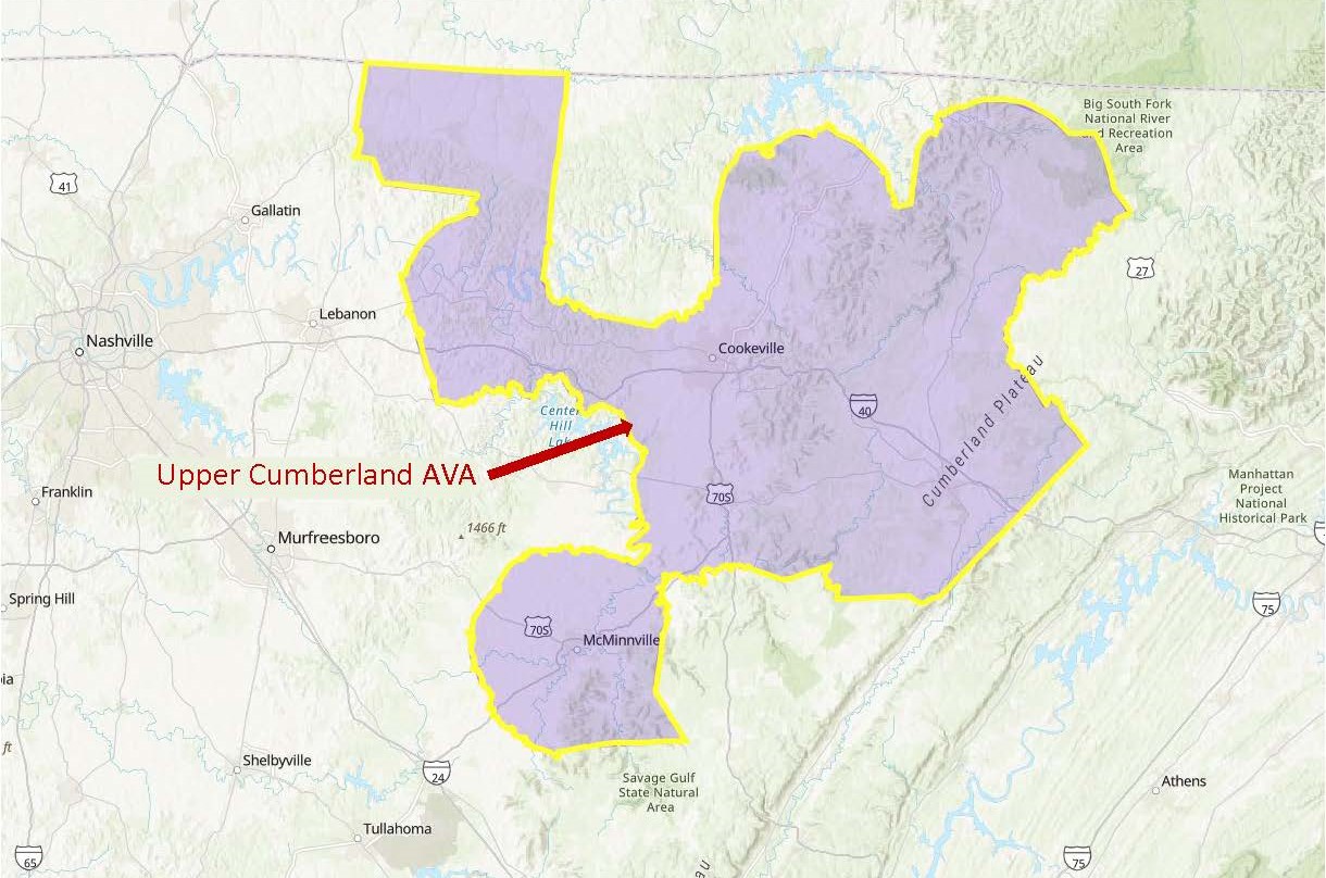
Base map via the TTB AVA Explorer (click to enlarge)
On May 15 (2024), the TTB (Alcohol and Tobacco Tax and Trade Bureau) of the United States announced the approval of the Upper Cumberland American Viticultural Area (AVA). The new AVA covers an area within Middle Tennessee. The newly approved AVA is not located within, nor does it contain, any other viticultural areas.
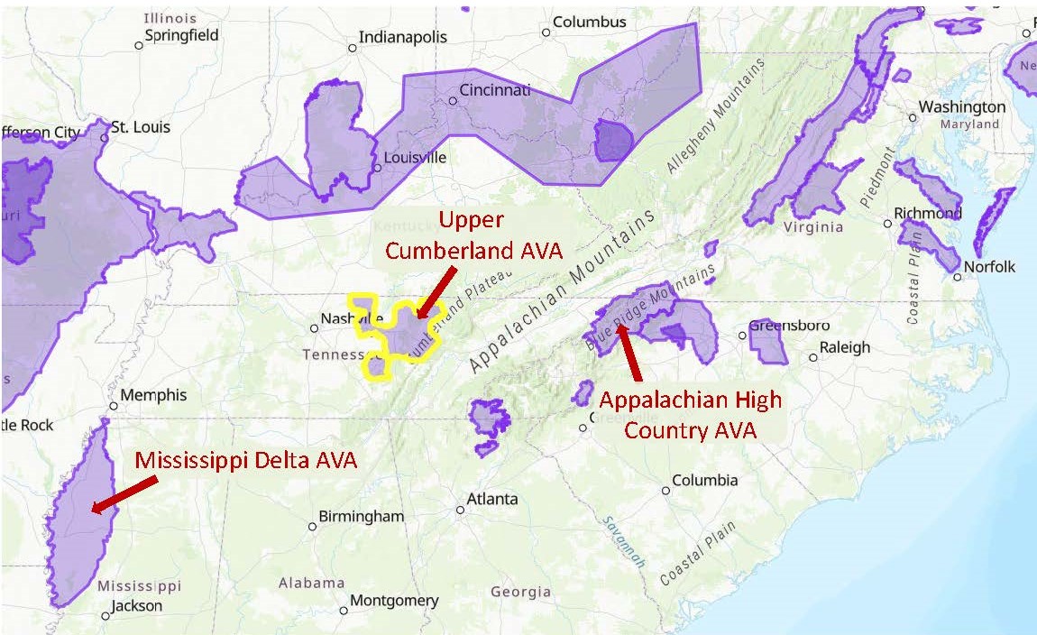
The Upper Cumberland AVA is the first AVA to be located entirely within the state of Tennessee. However, portions of two previously approved appellations are located within the state. These include the Appalachian High Country AVA (shared between Tennessee, North Carolina, and Virginia) and the Mississippi Delta AVA (shared between Tennessee, Mississippi, and Louisiana).
According to the original petition, the distinguishing features of the Upper Cumberland AVA include its elevation, soils, and climate—as described below.
Base map via the TTB AVA Explorer (click to enlarge)
Elevation: The Upper Cumberland AVA extends across the north-central portion of Tennessee. The AVA encompasses the western portion of the Cumberland Plateau, the Eastern Highland Ridge, and the eastern portion of the Outer Central Basin. The center portion of the AVA—located on a cuesta (ridge) known as the Eastern Highland Rim—contains elevations ranging from 600 to 1,000 feet above sea level (asl). In the eastern portion of the AVA (perched atop the Cumberland Plateau), the elevation ranges from 1,500 to asl. Elevations in the Inner Central Basin region (in the western portion of the AVA) fall somewhere between the other two areas, resulting from the erosion of an ancient uplift once known as the Nashville Dome. The average elevation of commercial vineyards in the Upper Cumberland AVA is 1,000 feet asl.
Soils: Limestone bedrock underlies most of the Upper Cumberland AVA. Topsoil is composed of alluvial and loess particulates composed primarily of shale, sand, and gravel.
Climate: The area within the Upper Cumberland AVA is slightly cooler than the surrounding areas (mainly due to elevation). The average growing season within the new AVA is 212 days with an average temperature of 67.5°F. The average annual precipitation is 50 inches.
The Upper Cumberland AVA stretches for over 50 miles covers a large area totaling 2,186,689 acres. At present, there are 55 commercial vineyards, 9 bonded wineries, and a total of 71 acres of vines within the region. Upper Cumberland Wineries include Chestnut Hill Winery, Del Monaco Winery, and Stonehaus Winery. The area is currently planted to an eclectic range of grapes, including vinifera, muscadine, and hybrid varieties.
When the Upper Cumberland AVA is brought into force—on June 14, 2024—the total number of AVAs in the United States will be 273.
Welcome to the world, Upper Cumberland AVA!
References/for more information:
Post authored by Jane A. Nickles…your blog administrator: jnickles@societyofwineeducators.org