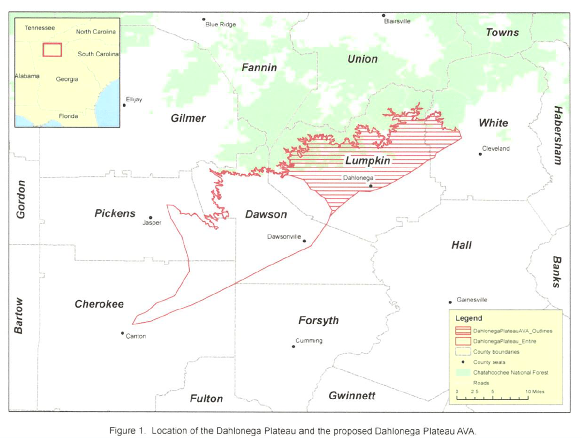
Map via the TTB website, as found in the original petition, submitted on behalf of the Vineyard and Winery Operators of the Dahlonega Region of Northern Georgia (April 2015).
Welcome to the world, Dahlonega Plateau AVA! As of June 29, 2018 the TTB has approved the Dahlonega Plateau AVA, located in Lumpkin and White Counties in the state of Georgia. The new AVA will be effective as of July 30, 2018—and this brings the total number of AVAs in the US to 242.
The petition for the Dahlonega Plateau AVA was originally submitted in April, 2015 on behalf of the Vineyard and Winery Operators of Northern Georgia. The namesake Dahlonega Plateau is a long, narrow plateau located in the northern foothills of the Georgia Piedmont. (The Piedmont [in the eastern United States] is an elevated section of land stretching from New Jersey to central Alabama, tucked between the Atlantic Coastal Plain and the Appalachian and Blue Ridge Mountains).
Georgia’ Dahlonega Plateau covers most of Lumpkin, Dawson, White, Pickens, and Cherokee Counties; however, the AVA only covers the northeast section of the plateau. The Dahlonega Plateau AVA is about 133 square miles in size, and is includes (at last count) 7 wineries and 8 commercial vineyards totally just over 110 acres of planted vines. Area wineries include Cavender Creek Vineyards, Three Sisters Vineyards and Winery, Wolf Mountain Vineyards and Winery, and Accent Cellars (they also make cider!).
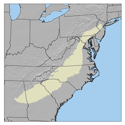
Map of the US Piedmont via USGS
According to the petition, the distinguishing features of the proposed Dahlonega Plateau AVA include the topography, described as gently rolling hilltops separated by wide valleys are an average elevation of 1,554 feet (474 m) above sea level. This warm and sunshine-drenched area is both well-suited for viticulture and distinct from the surrounding, more heavily wooded (and shaded) area.
The climate also differentiates the region within the AVA, as the area atop the Dahlonega Plateau is warmer than the area to its west and south, as the cool air from the higher elevations sinks down and settles in the area below, creating a risk of frost damage in the lower elevations. The majority of the area within the AVA has a growing season between 190 and 200 days and is classified in the intermediate range of the Winkler scale as Zone 3 and 4. Annual rainfall is approximately 62 inches per year, including 17 inches during winter.
During the open comment phase of the application process, the TTB received just one comment. The commenter noted that the Dahlonega Plateau is a ‘‘gorgeous mountain region’’ that has ‘‘unique wine-growing characteristics’’ that qualify it as an AVA. Welcome to the world, Dahlonega AVA!
References/for more information:
- The Federal Registry for Friday June 29, 2018 announcing the establishment of the Dahlonega Plateau AVA: https://www.gpo.gov/fdsys/pkg/FR-2018-06-29/pdf/2018-14035.pdf
- https://cavendercreekvineyards.com/
- Dahlonega Plateau AVA Petition
- http://www.threesistersvineyards.com/
- http://www.wolfmountainvineyards.com/
- http://www.accentcellars.com/wine-list
- The US Piedmont via Wikipedia: https://en.wikipedia.org/wiki/Piedmont_(United_States)