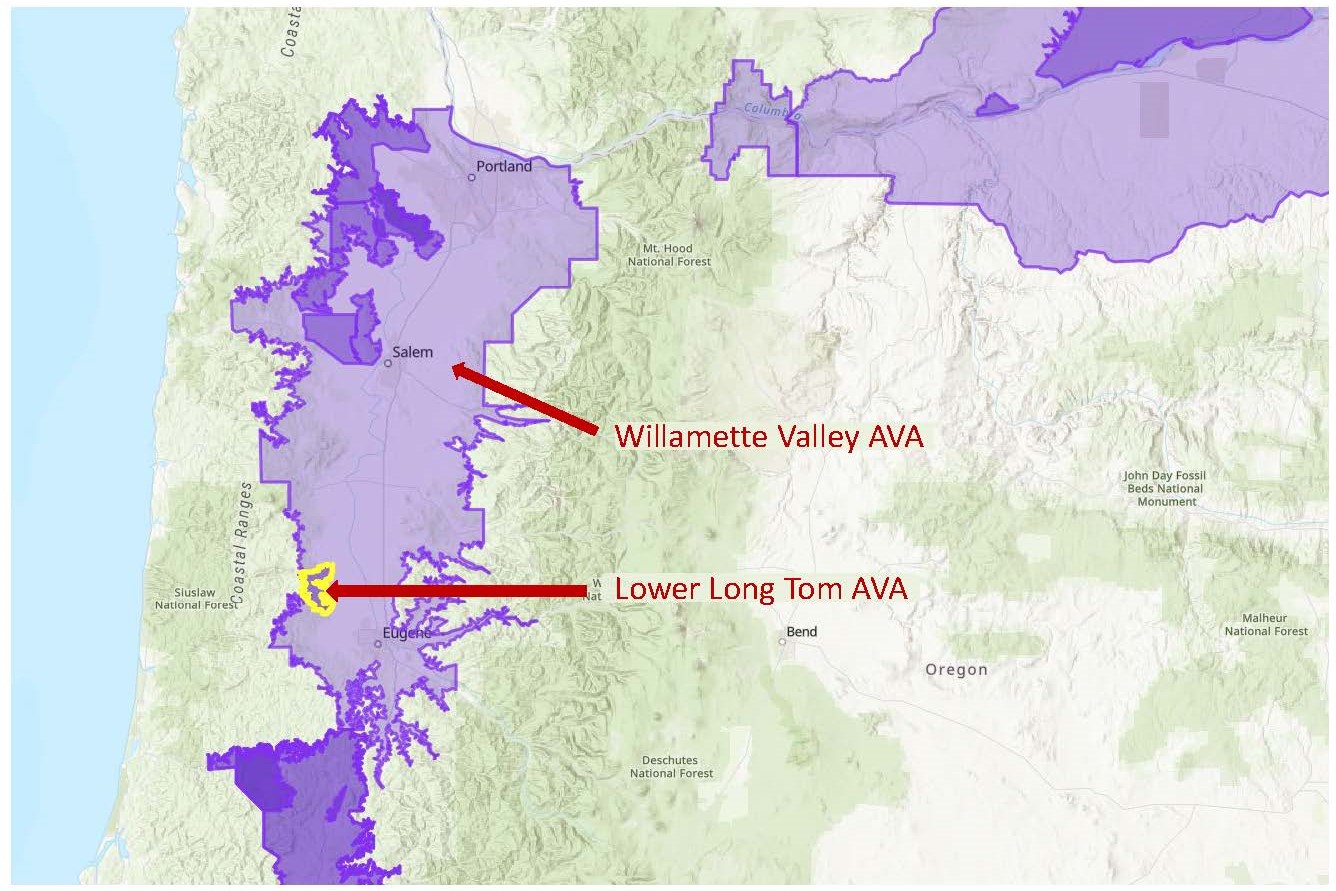
Map via the TTB AVA Explorer
On November 10, 2021, the TTB (Alcohol and Tobacco Tax and Trade Bureau) of the United States announced the approval of the Lower Long Tom AVA. When this new AVA comes into force on December 10 (2021), the total number of AVAs in the United States will be 260. Lower Long Tom represents the 22nd AVA in Oregon, and the tenth sub-appellation of the Willamette Valley AVA.
The Lower Long Tom AVA covers a total of 25,000 acres in portions of Lane and Benton Counties. It is located towards the southwestern edge of the Willamette Valley AVA, tucked along the eastern side of the Coast Mountain Range and about 14 miles (22 km) northwest of Eugene.
The appellation takes its name from the Long Tom River, located along a portion of its eastern boundary. The Long Tom River—a tributary of the Willamette River—flows northward for 57 miles (92 km) in the area between Eugene and Corvallis before joining the Willamette River. The AVA is located along the lower—downstream—portion of the river, north of Fern Ridge Lake.
According to the original petition, the distinguishing features of the Lower Long Tom AVA include its topography, soils, and climate, as discussed below:
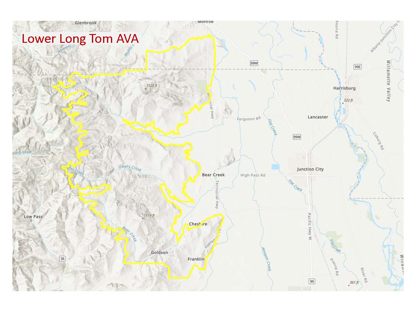
Map via the TTB AVA Explorer
Topography: The area within the Lower Long Tom AVA is comprised of rolling hills, punctuated by a series of (west-east) valleys and ridges created by the tributaries of the Long Tom River. Elevations range from approximately 1,000 feet/305 m asl (along the western edge of the appellation) to approximately 550 feet/168 m (in the center and eastern portions) before dropping to the Willamette Valley floor. The area to the west of the appellation lies within the Coast Mountain Range and contains elevations as high as 3,000 feet/915 m.
Soils: Bellpine soil (and Bellpine/Jory complex) are the main soils of the Lower Long Tom AVA. Bellpine soil consists of decomposed sandstone atop a sandstone or siltstone substrate. Bellpine soils are shallow and well-drained. Soils of the Bellpine/Jory complex combine decomposed sandstone and volcanic components and tend to have a slightly greater depth and capacity for water retention. In contrast, the soils in the areas surrounding the new appellation are primarily Jory (volcanic) soils, igneous (containing rocks and pebbles), or (to the west) more alluvial in character.
Climate: The Lower Long Tom AVA lies within the rain shadow of the Coast Range. Prairie Mountain—a particularly tall mountain, reaching 3,422 feet/1,430 m in elevation—is located directly to the west of the appellation, helping to block the cooling marine influence coming from the west. The cool air is thus re-directed to the areas north and south of the region and as such, the Lower Long Tom AVA is somewhat warmer than the surrounding areas.
The Lower Long Tom AVA is home to at least 22 commercial vineyards and approximately 592 acres of vines. The region is home to 10 wineries, including Benton-Lane Winery, High Pass Winery, Antiqum Farm, and Bennett Wine Company.
Pinot Noir is the predominant grape of the Lower Long Tom AVA; other leading grapes include Chardonnay, Riesling, Pinot Gris, and Sauvignon Blanc.
Welcome to the world, Lower Long Tom AVA!
References/for more information:
- Federal Register Nov 10 2021-Lower Long Tom AVA
- Lower Long Tom AVA Petition
- Lower Long Tom AVA Exhibits
- https://www.willamettewines.com/about-the-valley/ava-overviews/lower-long-tom/
Post authored by Jane A. Nickles…your blog administrator: jnickles@societyofwineeducators.org